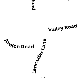
23 LANCASTER LN
Owner Information
LIM PAUL J
23 LANCASTER LN
MILTON, MA 02186


Property Details
23 LANCASTER LN is classified as a Single Family Residential (Colonial).
The primary structure on this property was built in 1960. There are 2,204ft2 of built area within this property. There is 2,204ft2 of residential/living space within this property. This property is listed as having 8 rooms.
23 LANCASTER LN is valued at $947,200. The land is valued at $489,500 and the structures are valued at $457,700.
This property is in Zone RB. Confirm with local Zoning Board authorities to ensure there are no overlays or other easements on this property.
The most recent deed for 23 LANCASTER LN is recorded at the local registrar in Book 27801, Page 534. 23 LANCASTER LN was last sold on Friday, July 2, 2010 for $770,000.
Assessment data from fiscal year 2021.
Flood Data
According to the FEMA National Flood Hazard Layer, this property does not appear to be in a flood zone. It may also be in an area not yet reviewed. Nonetheless, confirm this information prior to taking any action.
To view the flood hazards around this property, create a FEMA "Firmette" Map of the area around 23 LANCASTER LN.
Broadband Internet Providers
| Provider | Type | Bandwidth (mbps) | |
|---|---|---|---|
| RCN | Cable | 1000 | 20 |
| Crown Castle Fiber | Fiber | 0 | 0 |
| Viasat Inc | Satellite | 100 | 3 |
| VSAT Systems, LLC. | Satellite | 2 | 1 |
| HughesNet | Satellite | 25 | 3 |
| Verizon New England Inc. | DSL | 15 | 1 |
| Comcast | Cable | 1000 | 35 |
| RCN | Cable | 500 | 20 |
| GCI Communication Corp. | Satellite | 0 | 0 |
Broadband service provider data from December 2020.
Adjacent Properties
- 51 AVALON RD
Single Family Residential owned by MEIER GEOFFREY P & SINDU M - 78 COLUMBINE RD
Single Family Residential owned by ANDREWS JACOB - 72 COLUMBINE RD
Single Family Residential owned by BERNARDI MICHAEL J & ARLEEN M - 15 LANCASTER LN
Single Family Residential owned by WORTMAN ERIC MICHAEL - 55 AVALON RD
Single Family Residential owned by COTE ROBIN - 59 AVALON RD
Single Family Residential owned by MULHALL MARILYN H